
Walk an Orlando Street Directory
A sound address search separates what each record can prove. The Orange County Property Appraiser, or OCPA, links a street address to a parcel and named owner. OCPA WebMap then places that parcel among the lots around it. The Orange County Comptroller supplies the recorded deed trail, but its Official Records form has no direct address field. Voter data and old street sections can add resident names at a point in time. Each source has gaps, so the Orlando street directory should be built as a chain rather than treated as one list.
- Enter the street number and name in the OCPA Property Search. Copy the parcel ID, owner, situs address, mailing address, legal description, and deed citation.
- Open OCPA WebMap. Click nearby parcels or draw a line or rectangle along the segment to compare lots.
- If registered-voter evidence is needed, request the lawful public file from Orange County Elections and filter its residence field by street. The identity checker is not a street browser.
- Use the deed instrument or book and page from the parcel card in the Comptroller index. Follow grantor and grantee names while confirming the same legal description.
- For older households, consult Orlando directory street sections and census schedules. A directory can name an occupant even when that person did not own the parcel.
Record the date of every result. An owner, permit applicant, voter, and directory occupant may refer to different people or different years. That distinction keeps a by-address search useful and fair.
Search Orlando Streets in OCPA
OCPA has distinct Address, Names, Sales, Property Use, and Foreclosures modes. In address mode, omit the street number and enter the street name to broaden the result to a street. The official estimator warns against adding the street type. This is one of the fastest ways to assemble a parcel-based Orlando street directory because it returns tax parcels, not loose text matches. A parcel ID can be entered with or without dashes.
| OCPA field | Input | Required | Street-search use |
|---|---|---|---|
| Street Number | Number or text | No | Leave blank to widen the street query |
| Direction | Dropdown | No | Add a prefix direction when needed |
| Street Name | Text or autocomplete | Conditional | Search the name without street type |
| Owner Name | Autocomplete | No | Enter last name, then first name |
| Parcel ID | Text | No | Use the stable county parcel key |
A result may show owner names, separate mailing and situs addresses, values, exemptions, use, improvement facts, sales, and a legal description. Homestead is dated evidence tied to an owner. It is not a list of everyone at the address.
Map Orlando Streets Parcel by Parcel
OCPA WebMap shows the county parcel map, with layers for jurisdiction, subdivisions, ZIP codes, zoning, and mandatory or voluntary homeowner associations. Search by situs address, owner, parcel ID, property name, use, subdivision, section, or lake. Property-use searches can add a jurisdiction or ZIP filter and export a CSV list.
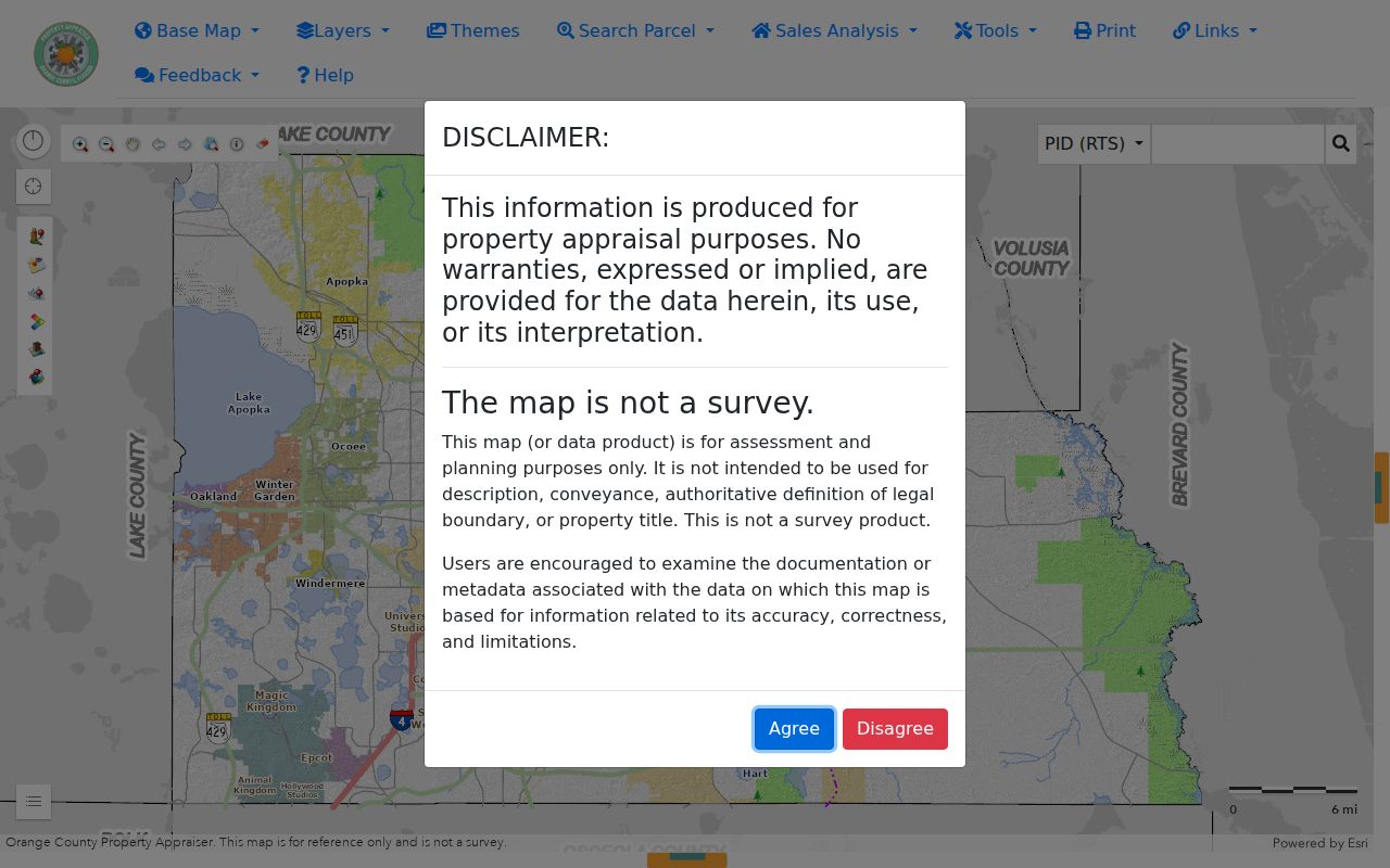
The map makes lot boundaries and street segments visible, which helps distinguish a corner parcel from the next address. Its Point, Line, Freehand, Rectangle, and Circle tools select groups of parcels. Yet OCPA says the viewer is not a survey or an authoritative title source. Confirm a boundary or ownership conclusion in the deed and plat.
Note: A postal city name does not prove that a parcel lies within Orlando city limits; check the jurisdiction layer.
Orlando Records Indexed by Address
Several custodians hold facts that can be aligned by street address or parcel. The city’s Property Information hub points to permit, zoning, ownership, tax, deed, and code sources. Their roles differ. Together they can show title, mapped context, work at a site, or a dated registration.
| Record Set | Keeper | What It Shows | Access |
|---|---|---|---|
| Property card | Orange County Property Appraiser | Owner, mailing and situs addresses, parcel facts | Free web search |
| Parcel GIS | Orange County Property Appraiser | Geometry, jurisdiction, subdivision, HOA, ZIP, zoning | Free WebMap |
| Official Records | Orange County Comptroller | Deeds, liens, plats, notices, grantors and grantees | Free index and images; certified copies paid |
| Permits and code | City of Orlando | Projects, status, dates, cases, and named roles | Web search or records request |
| Voter file | Orange County Elections | Nonexempt registered voters by residence street | Chapter 119 records request |
| Directory street section | History Center, UCF, and OCLS | Historic occupant, spouse, occupation, address | Appointment, library database, or digital copy |
The parcel ID ties the property card to the city permit search. A deed citation then connects that parcel to the Official Records index. The normalized street name connects those sources to the voter file and old street sections. Preserve directional prefixes and note any spelling change before deciding that a result is missing.
Bridge Orlando Addresses to Deeds
The Comptroller’s search does not accept a street address. Start at OCPA instead. Copy the deed instrument number or book and page shown on the parcel card, then open that citation in Orange County Official Records. This is the cleanest address-to-deed bridge and avoids forcing a street into a form designed for names and document citations.
The Comptroller search help explains its index fields and advises trying likely name spellings. The index is certified from January 1, 1878. OR Book 1 began in August 1955, while earlier work can lead into separate deed, mortgage, satisfaction, or historic index books.
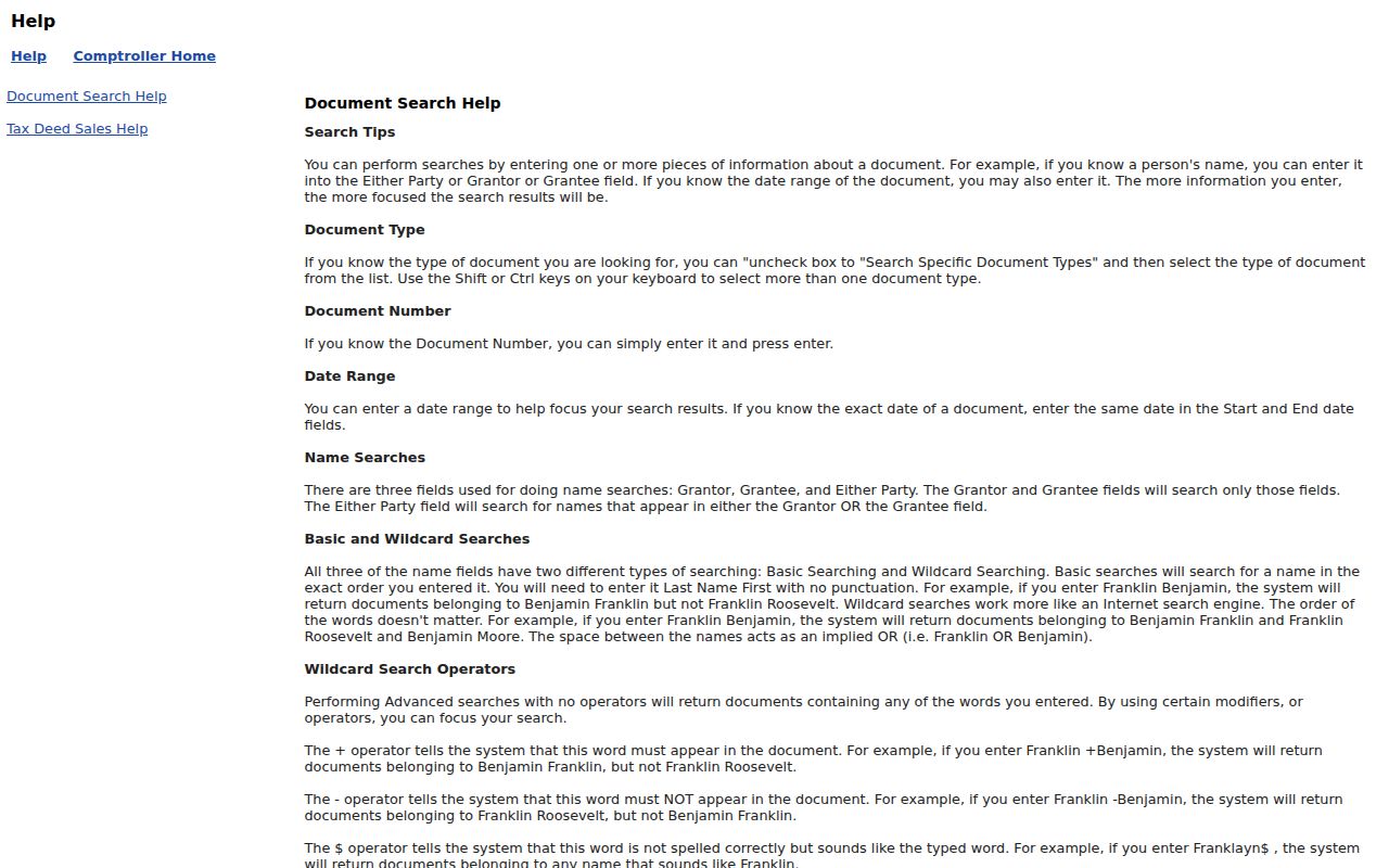
The captured help screen supports a citation-first search. Follow each grantor and grantee, but use the legal description to make sure the document concerns the same parcel.
Orlando Street Permits and Code Cases
Orlando’s permit search accepts Permit Number, Address, Project Name, and Parcel ID. Its address route can be split into street number, direction, street name, street type, and post direction. Results may show a permit number, project, address, description, application status, related permits, fees, inspection links, and plan-review controls.
The city property hub groups these address tools with zoning, taxes, deeds, and code cases.
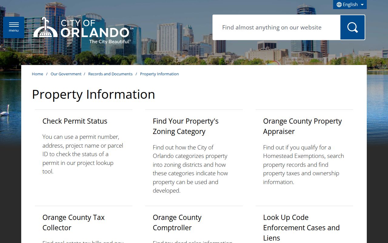
The hub makes a useful fallback when one search stalls. A permit applicant or contractor is a role tied to work, not proof of residence. Code cases searchable by incident number or address can show case status and public owner or responsible-party names, while protected complainant details may be withheld.
Read Orlando Address Terms Correctly
Street searches produce terms that look alike but answer different questions. Defining them early prevents a mailing address or map line from being mistaken for a household fact.
- Parcel
- A mapped unit of land with a county identification number.
- Situs address
- The physical location assigned to the parcel, distinct from the owner’s mail destination.
- Plat
- A recorded map that divides land into lots, blocks, streets, or easements.
- Criss-cross directory
- A directory organized by street and house number rather than only by a person’s surname.
Use the legal description when an old street name, annexation, or postal label changes. The city’s map shows 21 ZIP codes touching Orlando, many only in part. College Park entered expanded city limits in 1923, so a historic record may place the same ground outside Orlando even though its modern address does not.
Orlando Voters Along a Street
The Orange County elections status tool requires first name, last name, and date of birth. It confirms an individual and cannot browse a road. For by-street work, use the Elections public-record request form. The office can supply an electronic text or ZIP file under Florida Public Records Law, subject to exemptions.
A lawful voter file may include name, residence and mailing address, party, status, registration date, precinct, districts, and participation history. It never shows how a person voted. Social Security and state ID numbers are withheld, a signature may be viewed but not copied, and protected-address records receive added safeguards. An inactive record is not proof that the voter moved. A person missing from the file may simply be unregistered or protected.
Historic Orlando Streets by House Number
R.L. Polk street sections documented for 1938, 1941, 1943 through 1947, 1949, and 1952 let a researcher scan house numbers in road order. These volumes can identify a named occupant, spouse, or occupation between census years. They are useful for renters because the tax roll centers on ownership.
The Orange County Regional History Center holds Orlando directories from 1891 through 1998 with many gaps, and the Brechner Research Center is free by appointment. UCF and OCLS also provide digital or licensed resources. The collection details belong on the Orlando city directory page; here, the street section serves as one historic layer in a by-address chain.
Owners Are Not All Orlando Residents
Only 39.5 percent of Orlando homes were owner-occupied in the cited 2020 through 2024 census facts. That number is a strong warning against treating the parcel roll as a resident roster. The tax record identifies owners and where tax mail goes. It does not list every renter, child, relative, or other person at the site.
For a current Orlando street directory, label property results as ownership. Add voter data only as dated registration evidence. Use permits for named project roles, and reserve old directories for the year printed. Agreement across sources is useful, but it still must be described with care.
Limits of an Orlando Street Directory
No official Orlando street directory provides a live household roster. Protected voters, utility and delivery records, motor-vehicle addresses, private association lists, and many household members remain outside the method. Florida and federal law also restrict certain data. The Driver’s Privacy Protection Act limits motor-vehicle personal information, while Safe at Home and state exemptions can suppress qualifying addresses.
A map may be stale. A deed proves a recorded transfer, not who slept at the property last night. A voter record is dated, and a permit names people in specific project roles. State the narrow fact shown by each source. When a record is missing, use the official request, counter, library, or archive route instead of guessing.
Access also changes by custodian. OCPA and WebMap are free online tools. The Comptroller provides an online index and images, with paid plain or certified copies when a formal document is needed. Orange County Elections supplies the broader voter file through a records request, not through its identity lookup. City permit and code records may be searched online, while a narrow request to Orlando can reach records that the public interface does not expose. Historical directory, permit-ledger, and map work may require a Brechner Research Center appointment, a library card, or an archive inquiry.
Use a simple source log for each Orlando address. Record the exact street form, parcel ID, source name, record date, person’s labeled role, and the URL or book citation. Note whether an address is situs, mailing, or a return-to line on a deed. That log makes conflicts easy to spot. It also prevents an old result from being repeated as a present fact. If two records disagree, prefer the source that directly controls the fact and verify it with the custodian.
Lawful use. Orlando address records support family research, civic curiosity, and fraud checks. Florida law does not permit their use to stalk, harass, threaten, or harm anyone.