
Sources for Orlando Neighbors
Public records describe an Orlando block in layers. OCPA WebMap supplies parcel shapes, owner names, situs addresses, subdivisions, zoning, ZIP codes, and association geography. The Property Appraiser’s roll adds mailing addresses and exemption data. A lawful Orange County voter file can show registered voters by residence address after protected records are removed. City neighborhood maps name the community, while recorded association documents explain whether an HOA is mandatory or voluntary. None of these is a complete list of occupants.
| Source | What It Shows About a Block | Access |
|---|---|---|
| OCPA WebMap | Adjoining parcels, owners, situs, subdivision, HOA, ZIP and zoning | Free map |
| OCPA Property Search | Owner, separate mailing address, use, values and exemptions | Free portal |
| Orange voter file | Registered voters on a normalized residence street | Chapter 119 request; exemptions removed |
| City neighborhood inventory | Official neighborhood name, boundary and association contacts | Public city resources |
| Recorded HOA documents | Association name, covenants, bylaws and mandatory status | Comptroller index and Sunbiz |
The distinction between owner and occupant matters greatly in Orlando. Census estimates put owner occupancy at only 39.5 percent. A tax roll is therefore not a residents roster. An owner’s mailing address may be far from the parcel, and even a homestead exemption is dated owner-occupancy evidence rather than a list of every person in the home. Renters, children, nonvoters, and private household members may be absent from all open rolls.
Select an Orlando Block
The OCPA WebMap supports more than clicking one parcel at a time. Pan or zoom to the address, then open Tools and Spatial Search. Set the target layer to Parcel and draw a point, line, freehand shape, rectangle, or circle. A line can follow one side of a block. A rectangle can capture both sides and corner lots. Stop clears the selection. The result provides mapped parcel facts, not a survey or a legal boundary opinion.
OCPA’s NearBy Properties tool offers another route on a phone. It uses device location to find parcels within 250 feet. That radius can include lots behind the starting home as well as those next door, so check the map geometry before treating the list as the immediate block. Parcel IDs and legal descriptions are better continuity keys than a postal label.
Open the official WebMap before comparing surrounding parcels. Although its capture failed in the manifest, the live source remains the core map for this task.
Note: OCPA states that WebMap is not a survey, so use recorded plats or professional boundary work for a legal line.
Map Orlando Neighbors by Parcel
Work outward from one verified situs address. A situs address is the physical parcel location; a mailing address is where the owner receives tax mail. Keeping those fields separate prevents the most common block-lookup mistake. The parcel map and tax roll can identify owners, but they cannot establish every person who lives at each home.
- Enter the starting address in OCPA WebMap and confirm the parcel polygon, situs, parcel ID, and subdivision.
- Click each parcel that touches it, then widen to the opposite side and nearest corner parcels.
- Open the OCPA property card for each lot. Record the owner, mailing address, and dated homestead evidence without claiming full occupancy.
- Use a rectangle, line, or circle when the block shape makes parcel-by-parcel clicking too slow. Keep the selection date.
Once the question expands beyond the nearby radius, switch to the Orlando street directory workflow. That process handles an entire named street and its deed chain, while a neighbor search should remain focused on the immediate block.
Orlando Voter Data by Block
The Florida status checker and Orange County “Check My Info” route confirm a known voter with first name, last name, and date of birth. They do not browse a street. Block-level work requires the public voter file from Orange County Elections. Send a narrow request to Records@ocfelections.gov, retain the file date and documentation, then filter the normalized residence street and number range.
A delivered public file may include name, residence and mailing address, party, status, registration date, precinct, districts, and election participation history. It never shows how anyone voted. Social Security numbers, driver-license or state-ID numbers, registration source, and protected addresses are withheld. A signature may be viewed but not copied. Preregistered minors, Safe at Home participants, and other protected residents receive added confidentiality.
The Florida voter status service illustrates why the public checker is built for identity confirmation.
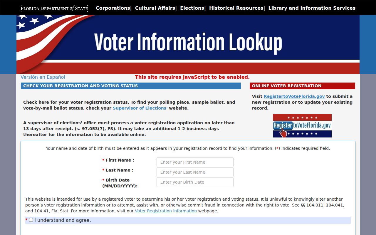
The required identity fields prevent the status tool from acting as an open directory of Orlando neighbors. A missing match also does not mean that a home is vacant.
Orlando Neighborhood Boundaries
The City of Orlando neighborhood inventory names districts such as Audubon Park, Baldwin Park, Callahan, College Park, Colonialtown, Conway, Delaney Park, Lake Nona, MetroWest, Milk District, Parramore, Rosemont, and Wadeview Park. The live inventory is broader and should be used instead of an old contact list. Postal city names and ZIP codes do not settle whether a parcel is in the city, so confirm jurisdiction in WebMap.
City Neighborhood Relations
Provides neighborhood boundaries, registration resources, and association contacts for groups within city limits. Email neighborhoods@orlando.gov or call 407-246-2169.
OCPA WebMap
Shows parcel geometry plus mandatory and voluntary HOA layers, subdivision, ZIP, zoning, and jurisdiction.
Orange County Comptroller
Indexes recorded declarations, covenants, bylaws, and association documents that may govern a parcel.
The city says it responds to neighborhood inquiries within three business days and collects association board contacts and meeting details. It does not publish a roster of residents or members. A voluntary association may include owners, renters, businesses, and other stakeholders. A mandatory HOA or condominium association rests on recorded covenants.
The Neighborhood Relations office is the best source for current city association resources. The page was captured for Orlando’s ZIP work rather than the neighbors manifest, so this page stays linked without reusing that image.
Compare Orlando Neighbor Sources
Official rolls and commercial neighbor tools serve different roles. Official records identify the custodian, record date, and legal role behind each name. Commercial compilations may merge old addresses, relatives, and licensed data without showing how a conclusion was made. A polished result or paywall does not make the match current.
| Source type | Strength | Main limit |
|---|---|---|
| OCPA and WebMap | Dated parcel and owner facts from an official custodian | Ownership does not prove all occupants |
| Orange voter file | Dated registration tied to a residence street | Nonvoters and protected records are absent |
| City and recorded association files | Boundary, organization and covenant evidence | No public private-member roster |
| Commercial compilation | May suggest a lead from many sources | Can be stale, merged, costly or unexplained |
Use a commercial result only as a clue and verify it with the office that holds the underlying record. Private congregation, block-watch, renter, delivery, and utility lists stay private unless people choose to publish them.
Public Safety Around Orlando Blocks
Florida maintains separate correctional and offender sources. The Department of Corrections Offender Search covers state custody, release, supervision, and fugitive records. A result can show identity, DOC number, status, location, sentence, and release facts. It does not cover every local case or prove a current home on the block.
The state corrections search interface appears below.
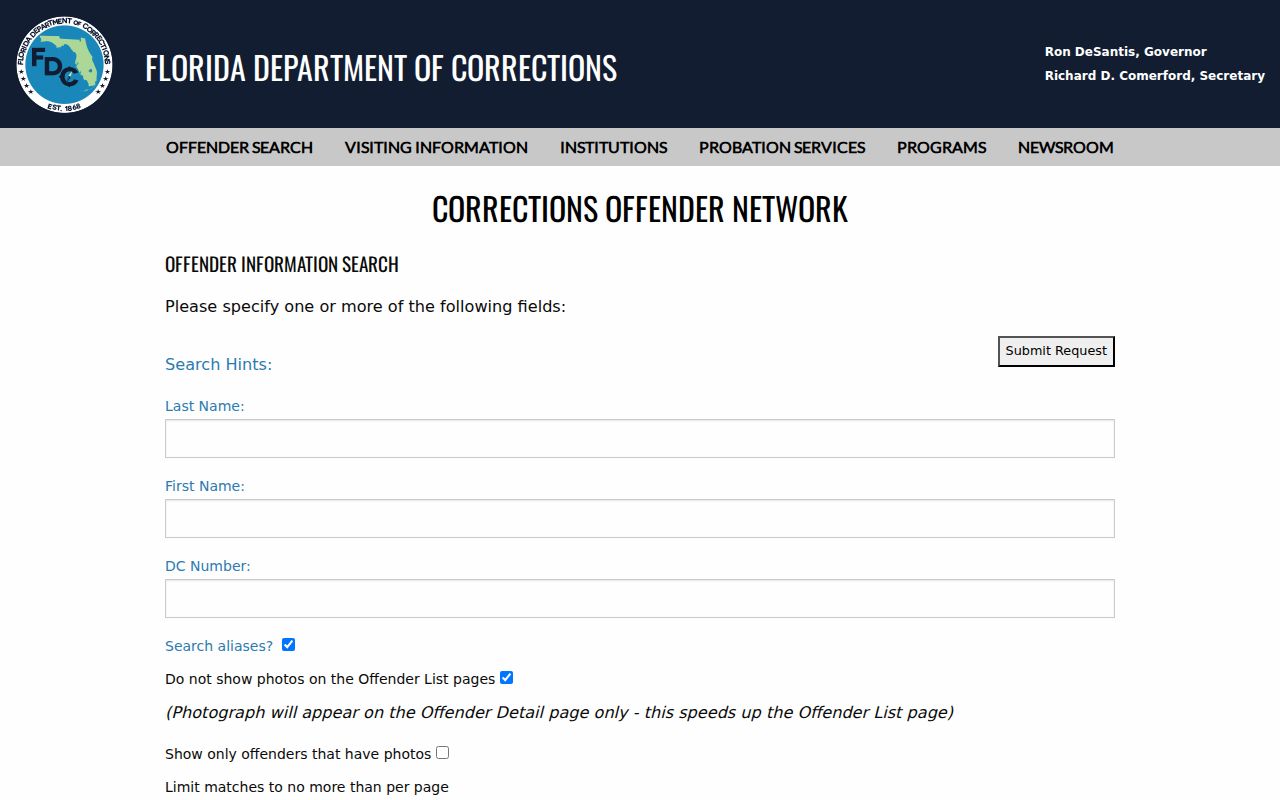
Check the record date and status rather than assuming an old location remains current.
The FDLE Sexual Offenders and Predators Search supports name, address or neighborhood, campus, and alert functions. Results may include a photo, identity, classification, qualifying offense, status, and reported address. FDLE warns that an address can change and bars use of the data to injure, harass, or commit a crime.
The FDLE registry page provides the official neighborhood-search route.
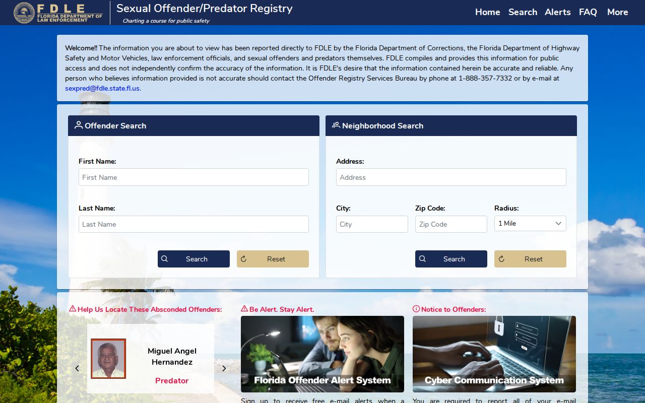
The registry should be read as a dated public-safety record, not as a general roster of Orlando neighbors.
Orange County Block History
Modern blocks make more sense when their jurisdiction and history are checked. Orange County began as Mosquito County in 1824, took its current name in 1845, and reached its bicentennial in 2024. Orlando became the county seat by 1856. The county’s public timeline helps place later neighborhood growth, annexations, and record custody in context.
The Orange County bicentennial timeline was captured as a local-history source.
The timeline explains why a block’s older records may sit with county or historical custodians even when the modern address is in Orlando.
Privacy for Orlando Neighbors
Several categories stay outside a neighbor lookup. Safe at Home gives qualifying victims a substitute mailing address through trained application assistants. Florida law also protects addresses for specified victims and occupational groups. DMV personal data is restricted by federal law. Utility accounts, delivery files, private association membership, congregation lists, children, and household members are not public block directories.
Florida stalking law covers a course of conduct aimed at a specific person that causes substantial emotional distress without a legitimate purpose, including some electronic conduct and credible threats. Public availability is never consent to watch or confront someone. When a record is wrong, contact the custodian that created it. A commercial privacy request cannot erase a lawful government record.
Lawful use. Research Orlando neighbors only for lawful personal, civic, or safety purposes. Never use public information to stalk, threaten, harass, or intimidate anyone.